Hydrologist working at quantifying the contribution of wetlands to global water storage variability.
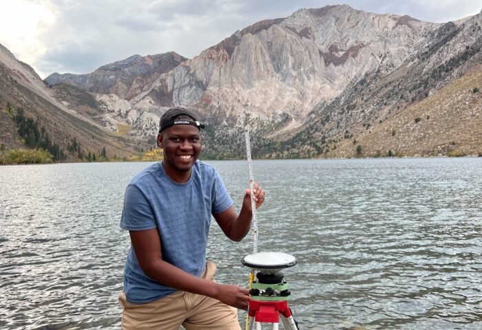
In December 2020, Solomon Kica completed his undergraduate degree in Land Surveying and Geomatics at Makerere University in Kampala, Uganda. He then joined the Jane Goodall Institute (JGI) Uganda as a GIS Analyst Intern in 2021 and later became the Conservation Science Manager. At JGI, he witnessed how science is critical to conservation success, which motivated him to pursue a PhD. Solomon is currently enrolled as a PhD candidate in Earth Science at the University of North Carolina at Chapel Hill (UNC-CH). His current research at UNC-CH in the Global Hydrology Lab also led to his participation in a 10-week graduate research internship at NASA’s Jet Propulsion Laboratory in Pasadena, California, in the summer of 2025.
SWOT AdAC: What is your field of research and how did you choose it?
Solomon Kica: My field of research is at the intersection of remote sensing and wetland hydrology. My goal is to quantify the contribution of wetlands to global water storage variability. After my undergraduate studies, I worked for two years at the Jane Goodall Institute in Uganda and was greatly inspired by Dr. Goodall’s work, specifically how science is core to the protection and conservation of our environment.
Wetlands are important components of the water and carbon cycles. Although they cover only about 6% of the Earth’s surface, wetlands disproportionately provide high ecosystem services and benefits. For example, about 40% of all plant and animal species live or reproduce in wetlands, wetlands provide an important source and sink function for green house gases, and they reduce the impact of floods by storing excess water during storms. The Global Wetland Outlook 2025 report estimates that the world’s remaining wetlands contribute up to $39 trillion in benefits each year.
While the role of Earth’s other water storage compartments, like lakes, in global water storage variability is commonly studied, the contribution of wetlands is poorly understood, despite the significance of these ecosystems for climate stability, biodiversity, water availability, and human well-being. My work aims to provide an improved quantitative understanding of their role in global water storage variability.
Quantifying wetland water storage variability is imperative because of the increasing water demand and water-related conflicts globally in the past decade, which require better management of water resources. Better management of wetlands globally is also of great benefit to the four billion people who rely on wetland services for health, food, and water security.
SWOT AdAC: How is your field of research related to SWOT?
SK: To achieve my research goal, I leverage data from the SWOT satellite mission. SWOT provides simultaneous observations of water surface elevation and extent, both of which are vital variables for estimating water storage changes over wetland environments. Our first validation results of SWOT data, published in May 2025 in Geophysical Research Letters, show that SWOT’s water-level observations are highly accurate and strongly correlated with on-the-ground measurements in vegetated wetland locations. The mean absolute error is less than 10 cm.
Prior to the launch of SWOT, wetland water storage change measurements were largely carried out at local and regional scales using on-the-ground or multi-satellite approaches. It was nearly impossible to obtain wetland water storage variability on a global scale. SWOT offers a novel way to derive these estimates over large wetlands, even in ungauged systems, where diffusive flow conditions limit on-the-ground measurements.
SWOT AdAC: What do you find exciting about SWOT?
SK: There is a lot to admire about SWOT, but I find the workings of its cutting-edge technology, the Ka-band Radar Interferometer (KaRIN), to be the most exciting. Its capability to calculate precise heights of the water surface across a 120-km-wide swath with each pass is truly captivating. Another feature I find commendable is that the SWOT water surface extent and height data are already pre-processed and tailored to be friendly to data users. With SWOT products stored in raster and vector formats, scientists needn’t apply any geometric or radiometric corrections, or compute interferometry themselves, which is very technically challenging, especially for global-scale studies.
SWOT AdAC: What are your plans after you’ve finished analyzing SWOT data?
SK: I plan to compare the wetland water storage variability estimates from SWOT with total terrestrial water storage change estimates from NASA’s Gravity Recovery and Climate Experiment (GRACE) satellite. The resulting dataset will allow me to assess the contribution of wetlands relative to already published estimates for lakes and groundwater. Additionally, I plan to incorporate the NASA-ISRO Synthetic Aperture Radar (NISAR) data once data from its nominal orbit become available.
SWOT AdAC: Besides SWOT, are you involved in another exciting research and do you want to share something about it?
SK: Beyond my research with SWOT, I am on the advisory team of a non-profit I co-founded in Uganda, known as MapRI. The organization utilizes satellite imagery and citizen science to address community challenges such as water inaccessibility and service deprivation. MapRI trains community volunteers to collect geospatial data through remote mapping and in the field using open-source tools such as OpenStreetMap. The collected data are used to create web maps, web dashboards and hard copy maps that are shared with community leaders for evidence-based community action and advocacy for improved service delivery. With support from Humanitarian OpenStreetMap Team, Open Mapping Hub — Eastern and Southern Africa, and UNDP’s Youth4Climate program, MapRI has facilitated resource allocation in more than 30 communities across Uganda.
