Investigating processes and interactions at coastal/estuarine/land interfaces and their influence on coastal hazards and inland flooding
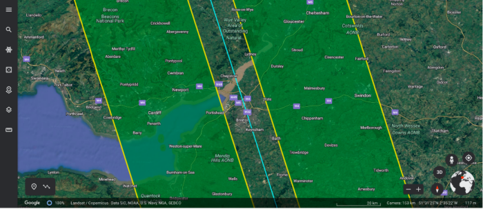
The Bristol Channel and Severn Estuary have an extremely high tidal range in the top 3 in the world, with the funnel-shaped topography being resonant with the M2 tidal component. This extreme tidal regime culminates during spring tides with a surfable tidal bore in the upper reaches of the estuary – a phenomena that should be within the swath region covered by the SWOT satellite during 1-day repeat orbit. The region also has large expanses of intertidal sand, mud and rocky platforms stretching for many kilometres at low water, with only the regional shipping ports having access to waters that experience the full tidal range for gauging purposes.
SWOT UK used existing and new datasets and models to examine challenging environmental questions about processes and interactions at coastal/estuarine/land interfaces and their influence on coastal hazards and inland flooding in the Bristol Channel and Severn Eastuary. Data collated were used to tackle the fundamental research problem of how fluvial and marine extremes combine in estuaries. The research is of high societal relevance since coastal/estuarine environments host many large cities of the world and, in the UK, are home to over 20 million people. The way flood hazard drivers combine is still poorly understood and poorly represented in probabilistic methods used to assess risk and exposure, e.g. impact of changing extreme conditions from sea-level rise and predicted changes to UK storm patterns.
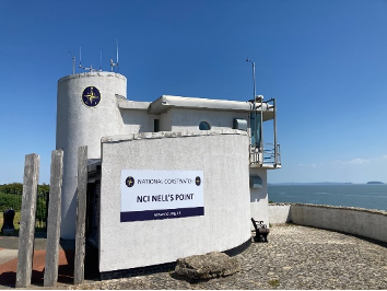
The study area has 20+ water level gauges operated by a range of stakeholders with a range of quality levels and rigour in terms of levelling. There are also a number of operational wave measurements and at least 2 Met stations available.
Activities of the team involved making detailed assessments of which water level gauges have the quality and levelling information for use in the SWOT cal/val work. Additional GNSS-Interferometry systems were installed to cover gaps in water level observations.
Two ADCP current moorings were planned during the 1-Day fast sampling phase of the SWOT mission, as well as Lidar flights. A high-resolution coupled hydrodynamic and wave model of the region was prepared.
The important focus in SWOT-UK on engagement and dissemination also strengthened collaborations with national and local stakeholders in flood warning and forecasting (e.g. Flood Forecasting Centre and UK MetOffice) and water resources monitoring and management (e.g. Channel Coastal Observatory, Environment Agency).
SWOT UK was funded by the Natural Environment Research Council and the UK Space Agency.
Principal investigators: Paul Bates (University of Bristol), Paul Bell (National Oceanography Centre), Simon Neill (Bangor University)
Contact point for the study site: Paul Bell (psb@noc.ac.uk)



Publications
| Year | Citation | DOI |
|---|---|---|
| 2026 | Rong, Y., Bates, P., Neal, J., Bell, P., Gommenginger, C., Lichtman, I. D., et al. (2026). Evaluating SWOT in the coastal zone: Comparisons with tide gauge and airborne LiDAR in the Bristol Channel and Severn Estuary, UK. Geophysical Research Letters, 53, e2025GL116590. | https://doi.org/10.1029/2025GL116590 |