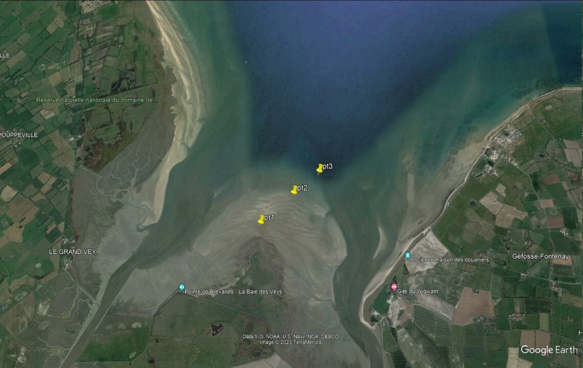
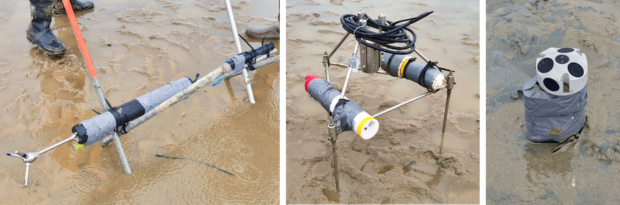
The setup of the Baie des Veys Cal/Val site in Normandy was completed on March 20th. Baie des Veys and part of the setup can be seen on Figure 1 and 2. Sensors were installed on 3 different points shown on Figure 3 in the Baie des Veys to get hydrodynamic measurements. Sensors, that can be seen on Figure 4, are the following:
- ADV and ADCP for current measurements
- ALTUS for sediment topography
- Pressure sensors for water level and wave height (4 Hz)
In addition to water level, these measurements will be used to validate SWOT-derived intertidal topography and SWOT’s Floodplain DEM product in coastal regions.
A big thanks to the field team: Romain Levaillant, Michel Simon, Julien Deloffre, Edward Salameh and Laurent Froideval.
The Baie des Veys and Raz Blanchard campaign | The Baie des Veys and Raz Blanchard blog | All the blogs